Bing Maps Adds Variety Of Hi-Res Image Improvements
Bing Maps has announced a series of updates to its high-resolution imagery, including expanded coverage, better mapping of ocean floors, cloud filtering and more. The prime features that Bing is touting involve what it calls “top of the world” imagery — those hi-res, top-down images. Improvements there include: Cloud cover filtering: Bing processes its base […]
Bing Maps has announced a series of updates to its high-resolution imagery, including expanded coverage, better mapping of ocean floors, cloud filtering and more.
The prime features that Bing is touting involve what it calls “top of the world” imagery — those hi-res, top-down images. Improvements there include:
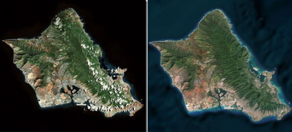
Cloud cover filtering: Bing processes its base satellite imagery and reduces cloud cover in areas where views are often blocked by persistent cloud cover. Bing’s example photos of Oahu show how that works:
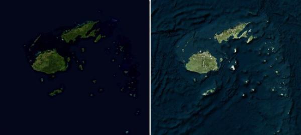
Another improvement involves the addition of ocean topography from the Scripps Institution of Oceanography. Ocean floor depths are now indicated by color shading, and the images are processed to minimize cloud and ice coverage. Here’s an example set of images of Fiji showing this addition:
Overall, Bing says it’s added more than 13 million square kilometers of new top-of-the-world imagery. It’s available on Bing Maps and within the Windows 8 Map App.
Opinions expressed in this article are those of the guest author and not necessarily Search Engine Land. Staff authors are listed here.
Related stories
About the author