Bing Maps Shows Super Bowl Spirit With New Venue Map, Streetside & Hi-Res Venue Imagery
Recent image updates show University of Phoenix Stadium being prepped for Sunday's Super Bowl.
With just four days to go until Super Bowl 49, Bing Maps has rolled out a series of updates focused on the place where it’s all happening on Sunday: University of Phoenix Stadium in Glendale, Arizona.
The updates involve new satellite and ground-level imagery, and a detailed seat map of the stadium itself. Here’s a look:
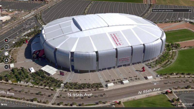
Satellite Imagery
If you have the Bing Maps Preview app for Windows 8.1, you’ll be able to see new 3D imagery from about the altitude that a blimp would fly — see the image above.
If you don’t have that app on Windows 8.1, “regular” Bing Maps also has new 2D satellite images of the stadium and its local area.
Streetside Imagery
Bing has updated its Streetside images around the stadium with photos that show the stadium being prepped for the Super Bowl crowd — new structures being built outside and so forth.
Detailed Venue Map
Bing Maps has added the stadium to its existing collection of venues that include detailed interior maps — in this case, showing all of the seating levels and sections inside.
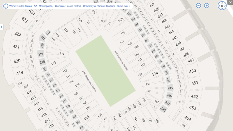
If you’re going to the game (lucky!), you probably already know full well where you’re sitting. Or if you’re not going, but you have friends who are, you can wistfully look at where they’ll be sitting while you’re at home.
Opinions expressed in this article are those of the guest author and not necessarily Search Engine Land. Staff authors are listed here.
Related stories
About the author