Google Adds Street Views To Step-By-Step Driving Directions
The Google LatLong Blog announced that you can now see street views turn-by-turn (when available) when you are seeking out driving directions via Google Maps. For example, when driving from the Empire State Building to Times Square, you can see that Google has street views available for every turn. A camera icon next to each […]
The Google LatLong Blog announced that you can now see street views turn-by-turn (when available) when you are seeking out driving directions via Google Maps.
For example, when driving from the Empire State Building to Times Square, you can see that Google has street views available for every turn. A camera icon next to each step of the directions is available to click on. Clicking on the camera shows you Street View imagery for that turn.
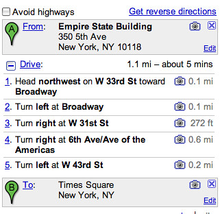
Here is an image of the driving directions with the camera icon:
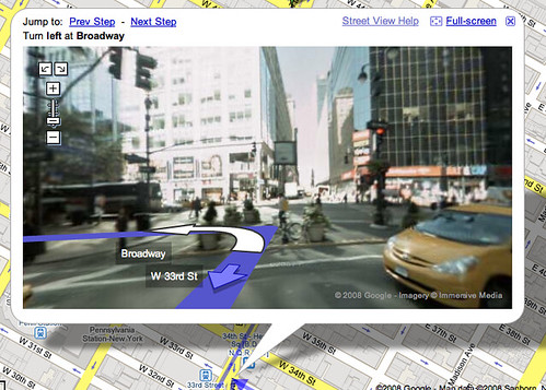
Here is Google telling me to turn left at Broadway on the Street Views layer:
Here is a street view image of Times Square New York:

The “B” pointer symbolizes it is point B on my directions.
So, if you are a visual type of directions seeker (like my wife), you can now see and memorize what store you need to hang a left at, as opposed to a street name.
Related stories
About the author