Google Earth Adds Real Time Traffic Layer
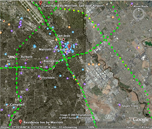
The Google Lat Long Blog announced that they have added a new layer in Google Earth to provide real-time traffic data. By activating the traffic layer, little green, yellow and red balls are overlaid on the highways and roads, each symbolizing the level of traffic congestion in that area. Here is a screen capture of […]
Barry Schwartz on August 21, 2007 at 9:34 am | Reading time: 1 minute
The Google Lat Long Blog announced that they have added a new layer in Google Earth to provide real-time traffic data.
By activating the traffic layer, little green, yellow and red balls are overlaid on the highways and roads, each symbolizing the level of traffic congestion in that area.
Here is a screen capture of San Jose traffic in Google Earth at 6:30AM:
Related stories
New on Search Engine Land
About the author
Staff
Barry Schwartz is a Contributing Editor to Search Engine Land and a member of the programming team for SMX events. He owns RustyBrick, a NY based web consulting firm. He also runs Search Engine Roundtable, a popular search blog on very advanced SEM topics. Barry can be followed on Twitter here.