Did Google Maps Lose England, Scotland, Wales & Northern Ireland?
The United Kingdom (to use its short name) is a complicated country, actually made up of four countries across two islands. If you were looking to understand it better, forget Google Maps. That’s because the service has lost the constituent countries of England, Scotland, Wales & Northern Ireland — as well as the island of […]
The United Kingdom (to use its short name) is a complicated country, actually made up of four countries across two islands. If you were looking to understand it better, forget Google Maps. That’s because the service has lost the constituent countries of England, Scotland, Wales & Northern Ireland — as well as the island of Great Britain.
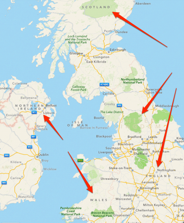
OK, the countries — and the island — are still there. They’re just not defined. Look here:

Quick, can you spot Wales? England? Where’s Scotland? How about Northern Ireland? Which is the island of Great Britain? Zoom in-and-out all you want, you won’t be able to locate them, either through labels or boundaries. Contrast that to Yahoo:

When you’re zoomed out on Yahoo, it uses the same “United Kingdom” label over the island of Great Britain as does Google. But when you zoom in, you see the three countries on the island of Great Britain — Scotland, England and Wales — as well as Northern Ireland on the island of Ireland, with the separate Republic of Ireland also shown, to the south.
Apple Maps operates similarly to Yahoo, where when you zoom in, you see the individual countries:
What’s going on? Is this even new? I’m checking on that. It was new to this person on Reddit, where I came across this oddity. Google also rolled out its new Google Maps last week, so this might be part of that. Plus, the Scottish island of Jura remains lost beneath the waves on Google Maps (click the image to enlarge):
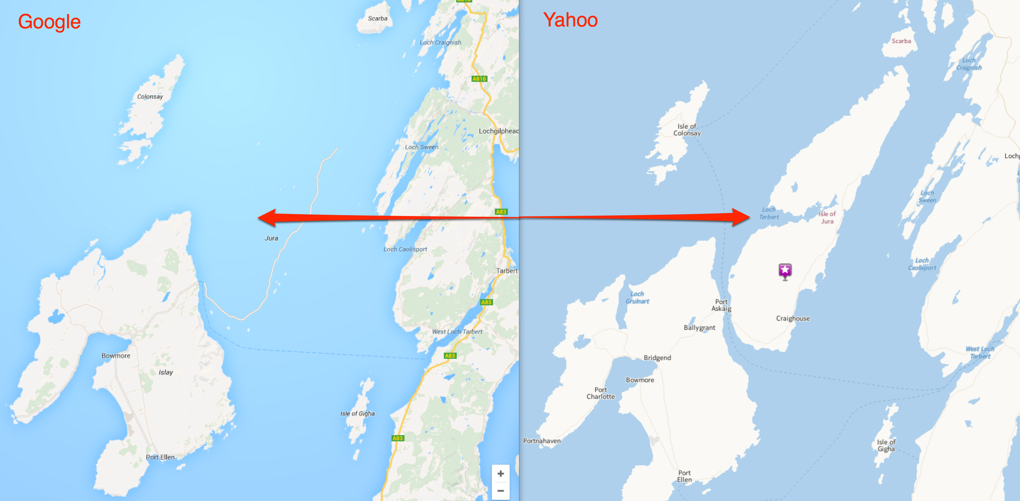
You can see where Jura should be by looking at the Yahoo Maps screenshot to the right of the one from Google Maps, above. Not only does Google put Jura underwater, but it also makes the A846 highway magically run on top of the sea.
I’m checking with Google about this — and for the record, Bing has the same issue, showing “United Kingdom” when you’re zoomed out and no country names when you zoom in.
As for those struggling with the makeup of the United Kingdom of Great Britain & Northern Ireland — and why newly-born Prince George won’t be “King of England” one day in the future, I highly recommend the video below, which is both funny and informative. Take the five minutes and learn some geography!
[youtube width=”560″ height=”315″]https://www.youtube.com/watch?v=rNu8XDBSn10[/youtube]
Related Stories
- New Google Maps Now Open To All, No Invite Needed
- New Google Maps App For iOS Includes Dedicated iPad Experience
- Are Google’s Results Getting Too Ad-Heavy & Self-Promotional?
- Google Ignites Controversy By Using “Palestine” On Homepage
- Jura Whisky’s Twitter Contest Makes The Most Of Google’s Map Mistake
Opinions expressed in this article are those of the guest author and not necessarily Search Engine Land. Staff authors are listed here.
Related stories
About the author