No Invasion, But Google Maps Involved In Spanish, Moroccan Island Dispute
Google is correcting how it displays a small island in the Strait of Gibraltar after erring twice and putting Google Maps in the midst of a years-old dispute between Spain and Morocco. At question is a tiny island that’s only about one-third of a mile in each direction. Spain calls it Perejil and Morocco calls […]
Google is correcting how it displays a small island in the Strait of Gibraltar after erring twice and putting Google Maps in the midst of a years-old dispute between Spain and Morocco.
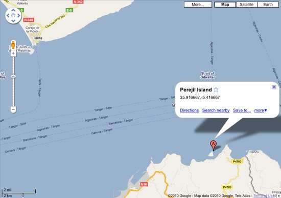
At question is a tiny island that’s only about one-third of a mile in each direction. Spain calls it Perejil and Morocco calls Leila; it sits about 275 yards off the northern coast of Morocco and about eight miles south of mainland Spain. In 2002, Moroccan soldiers set up a camp on the tiny island and a Spanish military operation removed them a week later.
According to the Associated Press, Google learned in July that it mistakenly labeled the island as Moroccan territory. But that was only the first mistake:
Google’s geopolitical team at its headquarters in Mountain View, California, consulted with international bodies including the United Nations, and recently decided to declare the islet a disputed territory that belongs to neither Spain nor Morocco, [a Google Spain spokesperson] said. Engineers have been working to make the correction, she said.
But since Monday, Google Maps has been attributing the islet to Spain, or to neither country, depending on the wording that is typed into the search engine.
A Google spokesperson didn’t have information today about when the fix would be in place, but shared this statement with Search Engine Land:
We understand that La Isla Perejil/Laila is a disputed island. We always keep a close eye on disputed matters and make every effort to update our maps accordingly when things change.
This is the second time in a matter of weeks that Google Maps has been involved in an international territorial dispute. An improperly displayed border between Nicaragua and Costa Rica was recently brought up during a long-running dispute between those two countries.
Fortunately, in this latest situation, no one from Spain or Morocco appears to be using Google Maps to explain or justify an incursion into the disputed territory.
International mapping, as the above proves, can be a touchy subject; Google announced earlier this year that had improved how it displays borders in more than 60 countries and regions.
Opinions expressed in this article are those of the guest author and not necessarily Search Engine Land. Staff authors are listed here.
Related stories
About the author