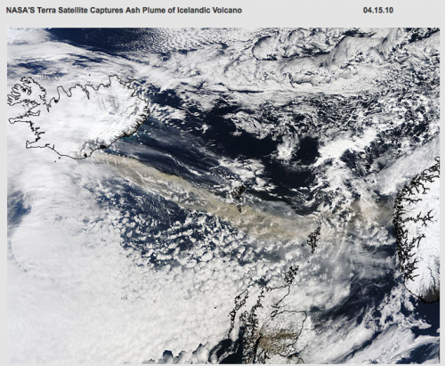
Volcano “Ash Plume” Captured By NASA, On Google Earth
When I heard yesterday that a volcano in Iceland had erupted and that airports across Europe were closed I thought it was a joke. But unfortunately it wasn’t. The volcano, Eyjafjallajökull (no that’s not misspelled), sent ash out into the sky for miles. The ash apparently creates a dangerous condition for planes, and so most […]
When I heard yesterday that a volcano in Iceland had erupted and that airports across Europe were closed I thought it was a joke. But unfortunately it wasn’t. The volcano, Eyjafjallajökull (no that’s not misspelled), sent ash out into the sky for miles.
The ash apparently creates a dangerous condition for planes, and so most airports across Europe grounded flights, which is continuing today. Calling the travel situation “chaos,” the NY Times reports that the domino effect of these closures may disrupt travel for weeks.
If you’re interested to see satellite images of the volcanic ash in the atmosphere you can now do so on Google earth, courtesy of NASA satellite imagery:
Contributing authors are invited to create content for Search Engine Land and are chosen for their expertise and contribution to the search community. Our contributors work under the oversight of the editorial staff and contributions are checked for quality and relevance to our readers. The opinions they express are their own.
Related stories
New on Search Engine Land
