How geotagging photos affects Google Business Profile rank: Study
How does geotagging photos affect local SEO? A 10-week study reveals surprising effects on 'near me' vs city-based Google ranking.

How does geotagging photos affect local SEO? A 10-week study reveals surprising effects on 'near me' vs city-based Google ranking.
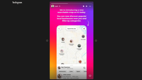
Instagram making it easier for users to discover restaurants, cafes, hotels and other local businesses.

Forget the idea that Pinterest is all about fashion photos, cute animals and inspirational messages. The company says it’s now hosting more than a billion Place Pins across four million Place Boards. Together, all this represents more than 300 unique countries and territories. That’s a lot of image and board geotagging going on. To make […]
It’s reasonable to say that the world of technology patents is screwed up and headed for some major reform. One area in which this is very apparent is location/mapping/geo. There are a number of seemingly conflicting or contradictory local and local-mobile patents that have been issued over the past several years. Some of these patents […]
About five months ago Twitter launched Twitter Places to provide tweets with more “context.” Matt covered it with enthusiasm and imagined its potential: the marriage of location and real-time communication. But nothing much has really happened since that time. There have been lots of geotagged tweets but Twitter still isn’t all that useful as a […]
Not to beat a dead horse, but as I said in my last column, I think 2009 was truly a watershed year for local search. Between Google’s introduction of the generic 10-pack, its beta test of local listing ads, dramatic improvements to Bing’s Local Listing Center, and numerous partnerships throughout the industry— all of these […]
Google is now adding public geotagged Picasa images to Google’s Street View on Maps. According to the Google Lat Long Blog: Millions of people already rely on Picasa Web Albums to share their photographs with friends and the internet community. Now, their public geo-tagged photos will help Google Maps users to get a better impression […]
Google keeps adding layers of data to its maps: images, articles, video, user lists and so on. In addition to a new, dedicated Street View site, the Google LatLong Blog yesterday announced that it had added “icons and labels of prominent businesses and places of interest directly on the map itself.” This effectively enables users to […]
Our own Barry Schwartz spotted this today on Google Maps: A search for rustybrick includes a link to see Flickr photos displayed on Google Maps: Clicking on that link leads to a fairly lengthy list of photos imported into Google Maps via the Flickr API. The photos are all from a Flickr feed that includes […]
No surprise here: Google Blogoscoped has spotted YouTube videos showing up on Google Maps when you click the “more” button (upper right) and select video.
Think of this post as a SearchBiz for Local, Maps & Mobile today; there was enough news to do a bit of a roundup. First up is Google’s announcement that it has dramatically expanded (“doubled”) the coverage available via StreetView, including many new states such as Maine, West Virginia, North Dakota, and South Dakota.
Tired of searching for “Paris” (France) on YouTube and mostly seeing video of Paris Hilton? A new geographic search feature (reported first by NewTeeVee) should take care of that. Video uploading users have been able to geotag videos on YouTube but not easily search for video by location. By contrast, Google Earth allows searching for […]
Google’s LatLong Blog announced new ways of finding more content on Google Maps, including geo-tagged YouTube videos, pictures from Panoramio, and localized Wikipedia content. We already covered the Google Maps Explore feature, but let me take you through similar content by way of the new “More” button. Lets travel to the Union Square area of […]
Flickr, which previously offered users the ability to search for photos by location or see photos clustered and arrayed on a map, is going further down this path. The company is revamping Flickr’s map explorer and introducing a new service called “Places.” Places are pages dedicated to, well, specific places featuring maps and other information […]
At Web 2.0 Summit this week, Flickr previewed a feature that will provide a new way to browse photos based on geographic location. They are making over their map explorer and introducing new Places Pages that will make it easier to see what’s going on around the world through pictures. The current map explorer lets […]
I just posted a bunch of videos to YouTube yesterday of skating down the boardwalk in Newport Beach. Maybe one day they’ll show up in Google Earth. That’s because Google Earth is now showing video clips that have been geotagged to particular areas, according to Google’s LatLong Blog. To find them, click Featured Content in […]
First, for map and online mapping lovers, there is the Wired piece, Google Maps Is Changing the Way We See the World, an interesting survey of the history of the mapping at Google, mashups, mapping APIs, Google’s acquisition of Keyhole (now Google Earth) and user-generated content on maps (My Maps). Then there is the tiresome […]
Brady Forrest at O’Reilly Radar writes about a new startup, Everyscape, which is seeking to take ordinary photographs and knit them into a “3D” image display for cities. According to Forrest, the company has been around since 2002 and received funding in 2004. Using a mixture of proprietary technology, professionals and community the site hopes […]
The conference Where 2.0 begins tomorrow in San Jose, California. It’s about mapping, mashups and location-based services and there should be a range of interesting announcements from companies large and small. To that end, Garrett Rogers speculates, based on domain name registrations, that Google will be announcing a “street view” mapping capability at the show. […]
The Google Book Search Blog announced a new feature they worked on together with Google Maps that shows you “places mentioned in this book” on the Google Book Search page. For example a Google Book Search result for Illustrated New York (1888) brings back a Google Map on the bottom left of the Google Book […]
ResourceShelf and O’Reilly Radar discuss a new offering from Yahoo Research Berkeley, in California: TagMaps. TagMaps are something like the word “tag clouds” meeting maps and Flickr. There are currently three offered, as described from the TagMaps site: World Explorer: “Explorer is based on photos users upload to the Flickr website. The World Explorer engine […]