OpenStreetMap debuts Google Street View alternative: OpenStreetView
The company seeks to crowd-source street-level photography on a global basis.

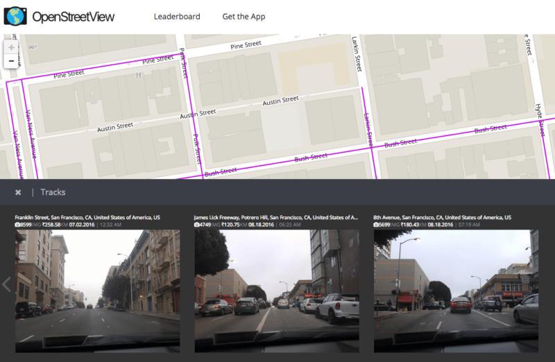
OpenStreetMap (OSM) has launched an effort to build an open-source version of Google Street View, called (not surprisingly) OpenStreetView. The hope is to use crowdsourcing to generate street-level photography for OSM on a global basis.
To do this, OSM supporter Telenav has built Android and iOS apps for those who want to capture images for upload while driving. There’s some technical complexity to recording and uploading images. Thus it’s really not accessible to general users; the project is for “mappers” and mapping enthusiasts.
To my knowledge, there are no incentives to participate beyond a leaderboard and/or a desire to see the project built. While a long shot, it’s quite possible that OpenStreetView will succeed over the long term, given the history and unlikely success of OSM itself. However, it will take years for the coverage to build up and become meaningful for a global user base.
There was an early attempt at an OpenStreetView in 2009, but it failed to gain significant traction. This project hopes to succeed where that one failed. Below is a video that lays out the vision for OpenStreetView and discusses some of the technology involved.
Postscript: Thanks Gary Price for pointing out Mapillary, a similar open-source Street-View like offering that has apparently been in existence for several years.
Contributing authors are invited to create content for Search Engine Land and are chosen for their expertise and contribution to the search community. Our contributors work under the oversight of the editorial staff and contributions are checked for quality and relevance to our readers. The opinions they express are their own.
Related stories
About the author