Google Releases Alabama Tornado Destruction Images & Maps Of Tornadoes
Google has posted before-and-after images of the terrible devastation left behind by the tornadoes that hit the South and parts of the East Coast of the United States earlier this week, with close-up views particularly of Tuscaloosa, Alabama. The easiest way to see the images is through a Picasa album that the company has posted. […]
Google has posted before-and-after images of the terrible devastation left behind by the tornadoes that hit the South and parts of the East Coast of the United States earlier this week, with close-up views particularly of Tuscaloosa, Alabama.
The easiest way to see the images is through a Picasa album that the company has posted. It explains more about these here.
Below is a montage photo of before and after for both Tuscaloosa, Alabama and Jefferson County, Alabama:
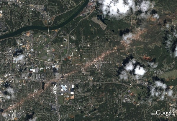
This stunning photo clearly shows the path of the tornado that went through Tuscaloosa, leaving a diagonal brown scar:
This image shows the destruction of the Charleston Square Apartments in Tuscaloosa:
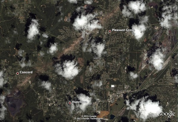
The photo below shows another path through Jefferson County, Alabama (Birmingham, Alabama is partly in this county):
When you search for some areas impacted by tornadoes in Google Maps, the company also triggers a special alert that leads to maps of where tornadoes touched down and Red Cross shelters. Here you can see it happening for a search on Concord, Alabama:
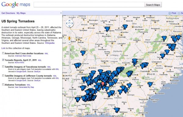
That leads to a map of tornado reports:
You can then use options on the left-side of the map to make American Red Cross shelter locations appear:
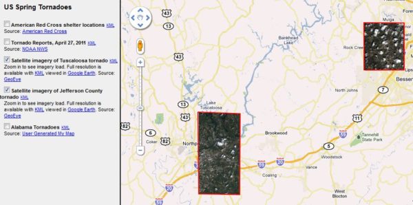
You can also use the two satellite imagery options to zoom in to where Google has updated Google Maps to show the destruction. When you check these boxes, you’ll see the areas that have refreshed images:
The updates only show in this special map page. If you try to find areas hit by the tornadoes using regular Google maps, you’ll still find older images. You can also reach the map page directly here, rather than having to search for it.
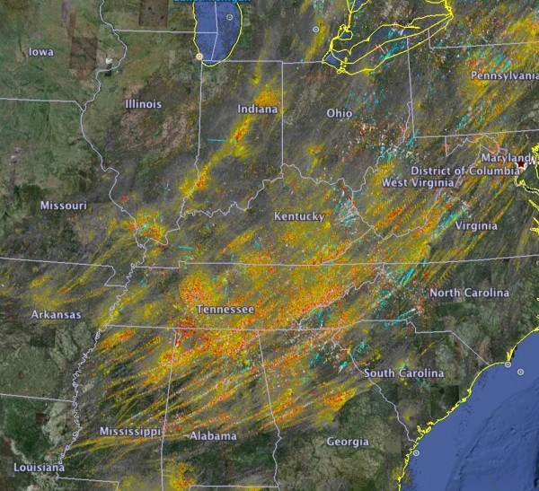
The National Oceanic & Atmospheric Administration also has a useful site about the April 2011 tornadoes in general. You’ll find the NOAA site here. Along with many facts, the site also contains an image showing tornado tracks color-coded to show where the strongest ones were. Yellow is strong; orange stronger and red shows the most severe:
Contributing authors are invited to create content for Search Engine Land and are chosen for their expertise and contribution to the search community. Our contributors work under the oversight of the editorial staff and contributions are checked for quality and relevance to our readers. The opinions they express are their own.
Related stories
New on Search Engine Land

