Google Earth Image Update: Spain Images
Google Earth is constantly obtaining new satellite images and updating their old ones. The Google Earth Blog stays on top of most these updates and has notified us of a recent update where Google has added more detailed imagery of Spain. The Google Earth Blog reports the imagery update covers the eastern edge of Spain, […]
Google Earth is constantly obtaining new satellite images and updating their old ones. The Google Earth Blog stays on top of most these updates and has notified us of a recent update where Google has added more detailed imagery of Spain.
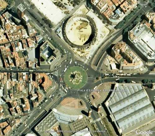
The Google Earth Blog reports the imagery update covers the eastern edge of Spain, including Barcelona. The update includes these towns in Spain: Valladolid, Leon, Burgos, Avila, Segovia, Salamanca, Andalucia, and Cataluña. Frank Taylor of the Google Earth Blog says that with one update comes others, and he is asking his readers to notify him if they notice any other updates.
Below is a picture from Google Earth of the Plaça d’Espanya in Barcelona, Spain:
Postscript: The Google LatLong blog posts an official statement with the first image update of 2008.
Related stories
About the author
In 2019, Barry was awarded the Outstanding Community Services Award from Search Engine Land, in 2018 he was awarded the US Search Awards the "US Search Personality Of The Year," you can learn more over here and in 2023 he was listed as a top 50 most influential PPCer by Marketing O'Clock.
Barry can be followed on X here and you can learn more about Barry Schwartz over here or on his personal site.