Google Earth Adds Real Time Traffic Layer
The Google Lat Long Blog announced that they have added a new layer in Google Earth to provide real-time traffic data. By activating the traffic layer, little green, yellow and red balls are overlaid on the highways and roads, each symbolizing the level of traffic congestion in that area. Here is a screen capture of […]
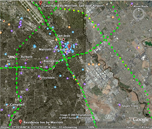
The Google Lat Long Blog announced that they have added a new layer in Google Earth to provide real-time traffic data.
By activating the traffic layer, little green, yellow and red balls are overlaid on the highways and roads, each symbolizing the level of traffic congestion in that area.
Here is a screen capture of San Jose traffic in Google Earth at 6:30AM:
Search Engine Land is owned by Semrush. We remain committed to providing high-quality coverage of marketing topics. Unless otherwise noted, this page’s content was written by either an employee or a paid contractor of Semrush Inc.

