Google Maps Becomes A Mini-Weather Center
It’s one of those things that you almost wonder why it wasn’t there before: current weather conditions on Google Maps. Well, Google has added current weather conditions around the world on Google Maps, and it’s a helpful addition. The new weather layer can be turned on or off by clicking the options widget in the […]
It’s one of those things that you almost wonder why it wasn’t there before: current weather conditions on Google Maps.
Well, Google has added current weather conditions around the world on Google Maps, and it’s a helpful addition.
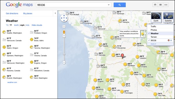
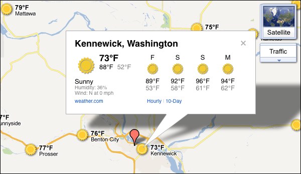
The new weather layer can be turned on or off by clicking the options widget in the upper right corner of the map; “weather” is one of the new choices. Weather data comes from the US Naval Research Lab, and you’ll see different cities as you zoom in or out on the map. In other words, as you zoom in, the weather layer will show conditions in smaller towns. You can also click on some cities to get more detailed weather for that area.
This is a bit of catch-up for Google, actually. Bing has offered weather as one of its “Map apps” for some time now, but Bing’s implementation is quite different. Rather than current temps, it focuses on radar and satellite imagery to show the weather in any location.
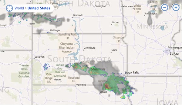
I’m not sure which approach is best. Google’s is certainly more immediately functional. Ideally, though, you’d be able to get both types of weather — Google’s data-centric approach and Bing’s more visual approach — at one search engine.
Or you could just go to Weather.com for that (and more).
Contributing authors are invited to create content for Search Engine Land and are chosen for their expertise and contribution to the search community. Our contributors work under the oversight of the editorial staff and contributions are checked for quality and relevance to our readers. The opinions they express are their own.
Related stories
About the author