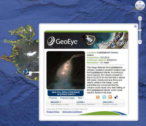
Iceland Volcano Maps: Where’s The Volcanic Ash? What Airports Are Closed? Plus, Refugees Tweeting!
Ash from the Eyjafjallajokull volcano in Iceland continues to ground flights across Europe. Indeed, I’m hosting a friend from Britain who can’t get home due to the volcanic ash crisis. This is an event made for mapping. So what have we got out there? Below, satellite images, a great New York Times airport closure tracker, […]
Ash from the Eyjafjallajokull volcano in Iceland continues to ground flights across Europe. Indeed, I’m hosting a friend from Britain who can’t get home due to the volcanic ash crisis. This is an event made for mapping. So what have we got out there? Below, satellite images, a great New York Times airport closure tracker, real-time flight displays and yes, tweets about the volcano, mapped.
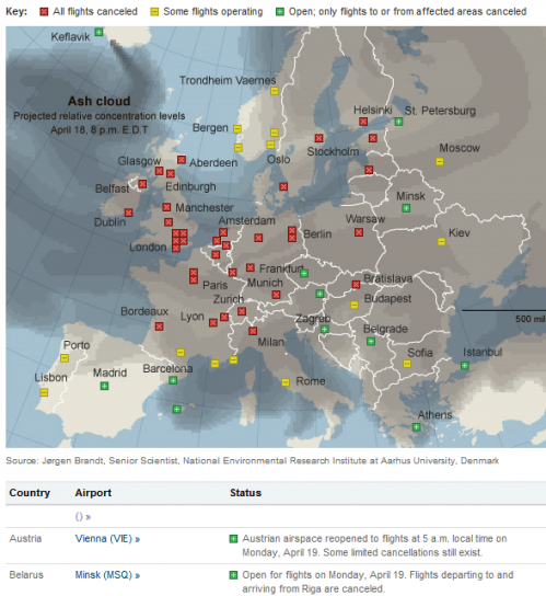
New York Times Airport Closures: Which airports are closed? Which are expected to reopen and when? An excellent map for volcanic ash refugees trying to know what’s happening. Well done, New York Times!
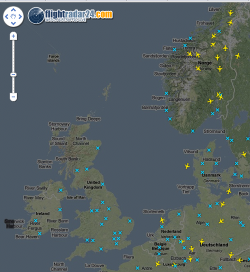
FlightRadar24.com: Want to see what’s flying — and not — visually? This site has traffic above Europe. In the image above, all the blue Xs are airports. Notice how above Britain right now, there are no yellow airplane symbols flying above or near those airports. Some of Europe has minimal activity.
RadarVirtuel: Similar to FlightRadar24, see what’s flying above Europe.
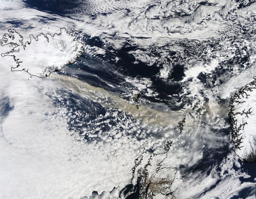
NASA Volcano Images: The US space agency has issued a variety of images over the past week, such as the one above showing the ash plume headed toward Europe. the NASA Modis Rapid Response System has a gallery with high resolution images that are constantly updated.
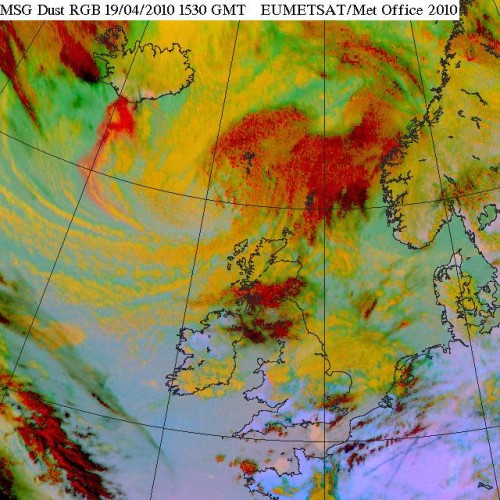
UK Met Office: The UK’s mapping agency offers a variety of maps in a special gallery, including the color enhanced satellite map above that shows the volcanic ash plume, ice clouds and more. Here’s an animation of the dust cloud moving across Europe. There’s also this map of dust observations across Great Britain. It’s pretty boring, however, simply a bunch of pinpoints you have to click on in order to find out how much dust is in the area at various locations.
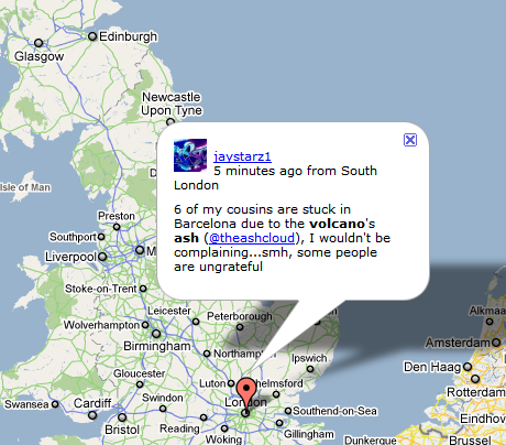
Volcanic Tweets, Mapped: It’s not a crisis if we can’t Twitter about it, and Virender Ajmani has created this cool mashup that puts tweets about being stranded on a map, along with other related volcanic tweets. You can focus on either Europe or the north eastern United States.
Google Earth & Volcano Imagery: Speaking of Google, we covered earlier how those using the software can now focus in on new high resolution images of the plume.
What’s missing? If you know of a great map, please leave a comment below. Me, I’m surprised that neither Bing Maps nor Google Maps has yet uploaded images and made them available in a way for those who want to view them through ordinary web browsers (rather than the Google Earth software), as was the case with Haiti Earthquake images (see Satellite Images Of Haiti Earthquake From Google & Bing Maps).
Contributing authors are invited to create content for Search Engine Land and are chosen for their expertise and contribution to the search community. Our contributors work under the oversight of the editorial staff and contributions are checked for quality and relevance to our readers. The opinions they express are their own.
Related stories
New on Search Engine Land
