Google Earth Shows Before & After Images Of Japan Earthquake And Tsunami
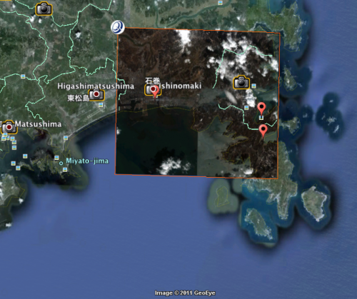
Google has captured a bunch of new satellite imagery that shows the devastation of the 8.9 earthquake and tsunami in Japan. You can see those images in Picasa or on Google Earth with a KML file (Japan Earthquake and Tsunami). Separately Google has set up a “people finder” for those still missing in Japan. It […]
Google has captured a bunch of new satellite imagery that shows the devastation of the 8.9 earthquake and tsunami in Japan. You can see those images in Picasa or on Google Earth with a KML file (Japan Earthquake and Tsunami).
Separately Google has set up a “people finder” for those still missing in Japan. It also offers a “crisis response” page with news, emergency resources and updates. You can also donate there directly to the Japanese Red Cross.
Contributing authors are invited to create content for Search Engine Land and are chosen for their expertise and contribution to the search community. Our contributors work under the oversight of the editorial staff and contributions are checked for quality and relevance to our readers. The opinions they express are their own.
Related stories
New on Search Engine Land


