Google Maps Plots Attractions, Points Of Interest
Google keeps adding layers of data to its maps: images, articles, video, user lists and so on. In addition to a new, dedicated Street View site, the Google LatLong Blog yesterday announced that it had added “icons and labels of prominent businesses and places of interest directly on the map itself.” This effectively enables users to […]
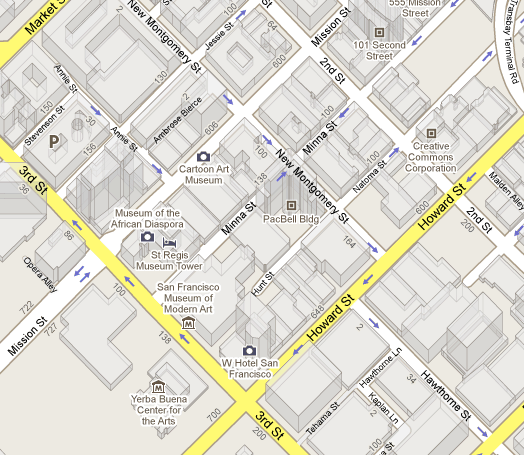
Google keeps adding layers of data to its maps: images, articles, video, user lists and so on. In addition to a new, dedicated Street View site, the Google LatLong Blog yesterday announced that it had added “icons and labels of prominent businesses and places of interest directly on the map itself.”

This effectively enables users to discover businesses, attractions and other points of interest on the map at a neighborhood level, without using the search box. The data are also in the mobile version of Google Maps.
There are particular icons that correspond to different business and location types. My hunch is that at some point in the reasonably near future we’ll see the introduction of a menu that opens a list of icons (as in Google Earth) and the ability to select particular categories to reveal their immediate locations on Google Maps:
There is so much information now available via Google Maps managing and presenting that information becomes an interface challenge. Simply exposing people to the existence of the data and different types of content is also itself a challenge.
In mobile Google has introduced an Android-only application called “Places Directory,” which is similar to a number of other local apps that tap user-location detection to find categories of businesses nearby simply by selecting from a list. It emphasizes “browsing” more than search. And this is, in a way, what the new icons do too.
On an interesting, related note the Google Earth Blog recounts a talk at a recent conference by Google Earth CTO Michael Jones in which he predicts that more and more photos will be auto-geotagged (and thus can be added to Google Maps):
Michael also talks about the marriage of Street View and Panoramio photos (see GEB storieshere and here). But, Michael goes on to predict (at about 5:52) that in the future it will be possible for people to upload photos to the “cloud” and have photos automatically geotagged. How? By comparing your photo with large repositories of known photos (like Street View and Panoramio) until you find a match.
Contributing authors are invited to create content for Search Engine Land and are chosen for their expertise and contribution to the search community. Our contributors work under the oversight of the editorial staff and contributions are checked for quality and relevance to our readers. The opinions they express are their own.
Related stories


