Emergency In Your Area? “Public Alerts” On Google Maps Shows Warnings
Google announced a new layer of data being added to Google Maps for public alerts. If there are emergency alerts in your area, Google will show them to you on the map, with more details on the alert. You can access it over at google.org/publicalerts. The map will load with a layer of data on […]
 Google announced a new layer of data being added to Google Maps for public alerts. If there are emergency alerts in your area, Google will show them to you on the map, with more details on the alert.
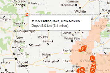
You can access it over at google.org/publicalerts. The map will load with a layer of data on top of it. You can search by location to see if there are any alerts in your area or just browse the alerts on the left hand side or on the map. The information is also available directly on Google Maps when you search for events in a location, such as [tornadoes in texas].

Here is a picture of zooming into a magnitude 2.5 earthquake near Cokedale, Colorado.
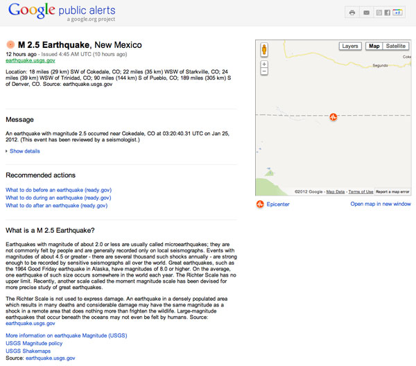
Clicking on the icon takes you to the alert’s details page that provides detailed information on that alert. From when the event happened, to where it happened, to where the information came from and what you can do about it.
The data comes from US National Oceanic and Atmospheric Administration (NOAA), the National Weather Service, and the US Geological Survey (USGS).
Related Articles:
- Send In The Clouds: Google Earth Adds Weather Layer
- Google Releases Alabama Tornado Destruction Images & Maps Of Tornadoes
- Google Suggestions Get Localized For Countries Around The World, News Alerts Improved
- Track Your Friends (And Yourself) With Google Latitude Location History, Alerts
- Google Maps Becomes A Mini-Weather Center
- Google Maps The Great Indoors (Android Only)
Related stories
New on Search Engine Land

